


CARIS Easy View - Windows 8 Downloads

CARIS Easy View 4.2.13
Discover the power of CARIS Easy View, a cutting-edge software for Windows 8. Seamlessly explore and analyze geospatial data with its intuitive interface. Unleash your creativity and efficiency with this must-have tool.
CARIS Easy View 4.2.13 - Key details
| License: | Freeware |
|---|---|
| Price: | FREE |
| File Size: | 106.00 MB |
| Released: | Aug 27, 2015 |
| Downloads: | Total: 61 | This Week: 0 |
| Keywords: | powerful, Geography, CARIS, interactive, versatile, software review, View Spatial Data, Map, user-friendly, Model, View Map, CARIS Easy View, Analyze Map, intuitive, Surface |
| Author: | CARIS |
| Author URL: | http://www.caris.com/ |
  |
Windows 8 Downloads - CARIS Easy View awards

CARIS Easy View - Full description
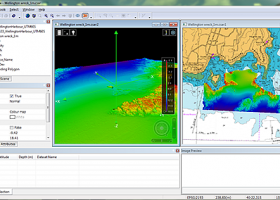
CARIS Easy View, developed by CARIS, is a cutting-edge software that revolutionizes the way you view and analyze spatial data. With its intuitive interface and powerful tools, it allows users to effortlessly navigate, visualize, and interpret complex geospatial information. Whether you're a professional in the marine industry or simply an enthusiast, CARIS Easy View is the ultimate solution for exploring and understanding spatial data. Download now and experience the future of geospatial analysis.
CARIS Easy View for Windows 8 - Post your review
CARIS Easy View Windows 8 related downloads
Model Aircraft Design software for Windows PC. Model Air Design is the new, quick and easy way to create airplane models. It's a modern ...
Model Air Design is a cross-platform software utility built ... nothing but a piece of cake. Model Air Design - Windows PC Software Model ...
3D Model Maker lets you create virtual 3D models in your computer. You can create anything your ... and Blender. This means you can create your models on the move on your tablet or PC ...
... automate statistical analysis and to write small applications, interactive tutorials with multimedia capabilities, as well as computer assisted interviewing systems. ...
... longitudinal profile of a terrain or set of surfaces. Triangulate a set of points or mesh a model surface; Take measurements on AutoCAD for construction project ...
... processing, plotting and nonlinear fitting. MagicPlot Pro is powerful enough and consistent. Get MagicPlot Pro and take ... auto recognized. Multipeak Fitting Enjoy peak-by-peak fit model creation and moving peaks and baseline with mouse. ...
MeV or Multiple Experiment Viewer is a Java tool to help you with ... MeV supports 5 input formats, and provides an intuitive graphical interface for clustering, classification, statistical analysis and ...
... processes, draw/interrupt 2D/3D graphs and draw chemical diagrams. Easy to use applications for the designer. Ideal for engineering, scientific professionals, ...
... development of the program. RPA is an easy-to-use multi-platform tool for the performance prediction of rocket engines. It features an intuitive graphical user interface with convenient grouping the input ...
... just need to redecorate - you can now view the finished project in advance. The program comes ... and construction plans with detailed 2D and 3D views. A comprehensive object catalog allows users to furnish ...
Windows 8 Coupons
-
EaseUS
20% off -
MacX Video Converter Pro
56% Off -
Driver Booster
35% Off -
WinX DVD Ripper
50% Off -
Media Player Morpher
85% Off
Saved Downloads
You have not saved any software.
Click "Save" next to each software.
Click "Save" next to each software.
Would you like to receive announcements of new versions of your software by email or by RSS reader?
FREE Registration Here!